cartodb_id_ | the_geom_GEO | accident_i_ | ambulance_ | cars_ | cyclist_ | date_c_ | descriptio_ | fatalities_ | govvehicle_ | handcart_ | landmark_ | lat_ | lon_ | mediaurl_ | motorcycle_ | othermed_ | overlappin_ | overturned_ | pedestrian_ | police_ | psv_ | reports_ | road_ | sacco_ | the_geom_webmercator_GEO | time_ | truck_ | tuktuk_ | verified_ | x_ | y_ | |
|---|---|---|---|---|---|---|---|---|---|---|---|---|---|---|---|---|---|---|---|---|---|---|---|---|---|---|---|---|---|---|---|---|
53 | GeoJSON | 996597 | null | 1 | null | 9/30/2015 | multiple accident at hamza 2 personal vehicles and 2 buses expect major traffic from hamza to town | null | null | null | makadara | -1.297869 | 36.8687944 | null | null | null | true | 1 | 7 | GeoJSON | 06:29:36 | null | true | 36.8687944 | -1.297869 | |||||||
36 | GeoJSON | 998327 | null | null | null | 7/16/2015 | traffic in msa rd inbound caused by accident at Subaru kenya | null | null | null | Subaru Kenya | -1.330688 | 36.856801 | null | null | null | null | null | 4 | Mombasa Rd | GeoJSON | 06:18:02 | null | true | 36.856801 | -1.330688 | ||||||
136 | GeoJSON | 998663 | null | 1 | null | 7/2/2015 | Eastern bypass before AP heading to cabanas there is an accident. Embassava and a personal. Heavy traffic | null | null | null | before AP, to Cabanas | -1.28714 | 36.95308 | null | null | null | null | 1 | 3 | Eastern Bypass | embassava | GeoJSON | 07:19:59 | null | true | 36.95308 | -1.28714 | |||||
1 | GeoJSON | 996223 | null | null | null | 10/15/2015 | accident on magadi rd next multimedia university. | null | null | null | multimedia | -1.37984 | 36.770279 | null | null | null | null | 1 | 3 | magadi rd | GeoJSON | 06:00:14 | null | true | 36.770279 | -1.37984 | ||||||
2 | GeoJSON | 996912 | null | null | null | 9/15/2015 | @kenyapolice on eastern bypass just before the army round about there is someone either lying on the road or knocked down | null | null | null | taj mall | -1.323823 | 36.900008 | null | null | 1 | null | null | 7 | eastern bypass | GeoJSON | 06:01:21 | null | true | 36.900008 | -1.323823 | ||||||
3 | GeoJSON | 999922 | null | null | null | 5/7/2015 | An accident just occurred on Mombasa Road on the way from town near the South B turnoff. | true | null | null | South B turnoff, Capital Center | -1.317847 | 36.835645 | null | null | psv | null | null | 1 | 5 | Mombasa Rd | GeoJSON | 06:02:04 | 1 | true | 36.835645 | -1.317847 | |||||
4 | GeoJSON | 997036 | null | null | null | 9/10/2015 | accident at parkroad ngara near involving nissan matatu and a truck which was overtaking near roundabout | null | null | null | ngara | -1.277951 | 36.830447 | null | null | null | null | 1 | 2 | park rd | GeoJSON | 06:02:11 | 1 | true | 36.830447 | -1.277951 | ||||||
5 | GeoJSON | 996204 | null | null | null | 10/16/2015 | accident at waiyaki way near kbc a bus overturned | null | null | null | kbc | -1.276678 | 36.813621 | null | null | psv | null | null | 1 | 3 | waiyaki way | GeoJSON | 06:02:31 | null | true | 36.813621 | -1.276678 | |||||
6 | GeoJSON | 998388 | null | null | null | 7/13/2015 | Accident at Sameer Business Park outbound to airport. Cars at a standstill. Use alternative route to airport via Enterprise Rd. | null | null | null | Sameer business park | -1.3305106 | 36.865158 | null | null | null | null | null | 10 | Mombasa Rd | GeoJSON | 06:03:07 | 1 | true | 36.865158 | -1.3305106 | ||||||
7 | GeoJSON | 999490 | null | null | null | 5/28/2015 | Accident on the eastern bypass towards town just before outer ring overpass | null | null | null | before Outer Ring overpass | -1.315315 | 36.910627 | null | null | null | null | null | 2 | Eastern Bypass | GeoJSON | 06:04:04 | null | true | 36.910627 | -1.315315 | ||||||
8 | GeoJSON | 997340 | null | 1 | null | 8/28/2015 | an eyesore accident at gitanga/james gichuru junction, cautiously approach. | null | null | null | gitanga | -1.289644 | 36.76158 | http://pbs.twimg.com/media/CNduKTlWUAIxnte.jpg | null | null | null | null | 1 | 2 | james gichuru | GeoJSON | 06:04:05 | null | true | 36.76158 | -1.289644 | |||||
252 | GeoJSON | 998932 | null | 1 | null | 6/22/2015 | accident on bomas karren rd | null | null | null | Bomas | -1.34249 | 36.76701 | http://pbs.twimg.com/media/CIFULvvUEAAQ17F.jpg | null | null | null | null | 1 | 2 | GeoJSON | 08:51:13 | null | true | 36.76701 | -1.34249 | ||||||
9 | GeoJSON | 998623 | null | null | null | 7/3/2015 | accident at vitafoam crazy jam use enterprise rd if going to town http://t.co/xtnLFzdL9P | null | null | null | at Vitafoam | -1.330409 | 36.857187 | http://pbs.twimg.com/media/CI9U0xNUcAAgipE.jpg | null | null | null | null | null | 3 | Mombasa Rd | GeoJSON | 06:04:07 | null | true | 36.857187 | -1.330409 | |||||
10 | GeoJSON | 996876 | null | 1 | null | 9/17/2015 | am accident at zimmerman, involving two saloon cars, police on site http://t.co/8ms5x4sbi1 | null | null | null | zimmerman | -1.213391 | 36.900208 | http://pbs.twimg.com/media/CPEt97GWUAAbe1E.jpg | null | null | null | true | null | 1 | GeoJSON | 06:04:33 | null | true | 36.900208 | -1.213391 | ||||||
11 | GeoJSON | 996755 | null | null | null | 9/21/2015 | accident on superhighway at survey, use service if you can @transportke @kinuthiajohnso1 | null | null | null | survey | -1.25209 | 36.859675 | null | null | null | null | null | 4 | GeoJSON | 06:05:06 | null | true | 36.859675 | -1.25209 | |||||||
12 | GeoJSON | 996407 | null | null | null | 10/7/2015 | pedestrian knocked down at kangemi outbound as you approch the flyover, body still on the rd, drive cautiously @policeke | true | null | null | kangemi | -1.2640976 | 36.7469767 | null | null | 1 | true | null | 8 | waiyaki way | GeoJSON | 06:06:06 | null | true | 36.7469767 | -1.2640976 | ||||||
13 | GeoJSON | 998364 | null | null | null | 7/14/2015 | #Accident Alert: At museum hill near Kipande rd junction involving a lorry and 14 seater matatu, @EMS_Kenya & NCC fire brigade activated | null | null | null | Museum Hill | -1.273477 | 36.813378 | null | null | null | null | 1 | 3 | Kipande Rd | GeoJSON | 06:07:23 | 1 | true | 36.813378 | -1.273477 | ||||||
14 | GeoJSON | 999836 | null | null | null | 5/12/2015 | Motorcycle accident on Ngong Rd near racecourse. Traffic building up. http://t.co/7w2LCoOvUO | null | null | null | Racecourse | -1.30647 | 36.73889 | http://pbs.twimg.com/media/CExjIBUWIAAsGAi.jpg | 1 | null | null | null | null | 1 | Ngong Rd | GeoJSON | 06:07:30 | null | true | 36.73889 | -1.30647 | |||||
15 | GeoJSON | 999006 | null | null | null | 6/19/2015 | Accident near Race Course Ngong Rd exercise caution | null | null | null | Racecourse | -1.30647 | 36.73889 | http://pbs.twimg.com/media/CH1d9QiWUAAJQQ8.jpg | null | null | null | true | null | 4 | Ngong Rd | GeoJSON | 06:07:55 | null | true | 36.73889 | -1.30647 | |||||
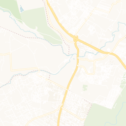
16 | GeoJSON | 997521 | null | null | null | 8/18/2015 | there's an accident after utalii on the thika superhighway. traffic is backing up but there's a cop. | null | null | null | utalii | -1.2573079 | 36.8542385 | null | null | null | null | null | 2 | thika superhighway | GeoJSON | 06:08:34 | null | true | 36.8542385 | -1.2573079 |


